This system was developed by Francis Li, Sam Madden, and Megan Thomas during the course of IS247 in the Berkeley SIMS department.
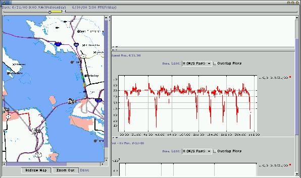
The screenshot above demonstrates the basic layout of the system -- the map on the leftside displays roads, incidents, and traffic cameras in the bay area, either at the current time or at some time in recent history. Traffic incidents are fetched in real time by querying the CHP, and we have access to some real time sensor data which is used to generate the plots on the right side of the drawing above.
The software picture above is freely available, here. But chances are it won't be particularly useful, as it requires a fairly specific online environment which won't be generally available outside of Berkeley. Over the course of the project, however, a fairly significant effort was undertaken to extract information from the Tiger Census and Map data files, and that code is worth sharing with anyone who may need to use the Tiger files to generate their own maps. As of the time of this writing, it appears that there are a number of commercial sources using or providing the Tiger data in some parsed format for a lot of money, but no publicly available code to extract information about roads or other data file features. We've also implemented a system to plot arbitrary sections of the US, and to overlay lines and images at specified longitude/latitude locations on top of those files.